The image below is from Book JP 3, page 545, recorded in 1858 in Queen Anne's County, MD. It records the sale of a tract of land owned by my 2x great-grandfather Samuel A. Sparks and his brother Daniel B. Sparks to William F. Parrott.
 |
| Queen Anne's County Court records, Book JP 3, page 545, 1858 |
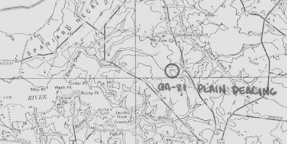
The Inventory of Historical Properties on the Maryland Historical Trust site has a document describing the house on "Plain Dealing" located in Spaniard Neck. This is one of the properties adjoining the Sparks land, so it should give an idea of the approximate location. The map below is from page 10 of the Inventory of Historical Properties document on Plain Dealing.
 |
| Location of "Plain Dealing" in Queen Anne's County, MD |
The next record is from Book JW 7, page 518, recorded in 1878. This record names the siblings of Samuel and involves a tract of land "commonly known as "The Sparks Lot". In this transaction, James H. Sparks and his wife Martha M. Sparks are selling "The Sparks Lot" in Spaniard's Neck to Charles Gilliam for $150. "The Sparks Lot" adjoins the land of Charles Gilliam, Eliphat Higgins and faces the public road leading from the Methodist Episcopal Church through the woods to the land of Col. John R. Emory. The land contains about 8 7/8 acres and is the same land which descended from Daniel Sparks, father, to Robert M. Sparks, Martha Sparks, wife of George W. Meredith, Daniel B. Sparks, Samuel A. Sparks, and James H. Sparks, his children. The named children had earlier conveyed their interest in the land unto James H. Sparks, with the exception of Daniel B. Sparks. In this transaction, James says that he will procure a conveyance from Daniel B. Sparks and his wife.
 |
| Queen Anne's County Court records, Book JW 7, page 518, 1878 |
I didn't know the names of Samuel's siblings or father before seeing this record. Thanks very much to George Sparks for sending me the information about the records! George also sent me a copy of Samuel's death certificate, but unfortunately, it didn't list his parent's names. We still don't know who his mother was. Was there a sixth sibling? The earlier record mentions that each was entitled to 1/6 of the land, but the later record only names 5 siblings. From the names listed in these two records, I came up with the following tree.
To Do:
- See if I can locate the other land records mentioned.
- The children of Daniel gave conveyance of their interest in the land to their brother James.
- Is there a record of Daniel giving conveyance to James?
- The land was deeded to John Sparks by William Ringgold on May 5, 1823.
- Search for inheritance records for the father Daniel and his brother John.


No comments:
Post a Comment